
Do You Really Need an Elevation Certificate?
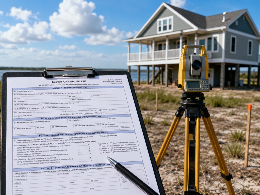
Here is what most developers get wrong about the elevation certificate. They think it is just an insurance form. It is not. It is a legal record of your building’s elevation that lenders, insurers, and local governments all rely on. Get it right and it can save you thousands. Get it wrong and it can stall your entire project.
If you are building or developing in a flood-prone area, this document matters more than most people think. And getting it wrong, or skipping it entirely, can cost you.
What Is an Elevation Certificate?
An elevation certificate is an official document. It records the elevation of your building compared to the Base Flood Elevation (BFE) in your area.
The BFE is the height floodwater is expected to reach during a major flood event. Think of it as the flood “benchmark” set by FEMA.
The certificate shows:
- The lowest floor elevation of your structure
- The elevation of your lot
- Whether your building is above or below the BFE
- Flood zone classification of your property
A licensed land surveyor prepares this document. It follows FEMA’s standard form, officially called the Elevation Certificate (FEMA Form FF-206-FY-22-152).
Who Actually Needs One?
Homeowners in Special Flood Hazard Areas
If your property sits inside a Special Flood Hazard Area (SFHA), you likely need one. SFHAs are labeled as Zone A, AE, V, or VE on FEMA flood maps.
Flood insurance is required by most lenders in these zones. And the elevation certificate is what your insurer uses to calculate your premium.
Without it, you are often placed in a higher-risk rating. That means higher premiums, sometimes by hundreds of dollars per year.
Developers and Builders
This is where many developers make costly mistakes.
If you are building a new structure in or near a flood zone, you need an elevation certificate at multiple stages:
- Pre-construction: To confirm design compliance with local floodplain ordinances
- During construction: Some jurisdictions require an interim certificate
- Post-construction: A final certificate records the finished floor elevation
Skipping any of these steps can delay your certificate of occupancy. It can also trigger costly redesigns.
4 Things Developers Often Get Wrong
1. Assuming You Are Outside the Flood Zone
FEMA flood maps are not always current. A property can sit in a low-risk zone on paper but still flood regularly. Coastal and low-lying areas are especially prone to this.
Always verify the actual ground elevation against the BFE. Do not rely on the map alone.
2. Using an Outdated Certificate
Elevation certificates expire when flood maps are updated. If FEMA remaps your area, an old certificate may no longer be valid.
If you are buying or selling, check the date on the certificate. A surveyor can issue a new one based on current map data.
3. Thinking It Only Affects Insurance
The elevation certificate does more than set your insurance rate. Local governments use it for:
- Building permit approvals
- Floodplain variance requests
- Determining compliance with the National Flood Insurance Program (NFIP)
If you are developing a multi-unit or commercial property, you may also need it to satisfy state and local floodplain management regulations.
4. Not Using It to Challenge Your Flood Zone
Here is something many developers do not know. If your elevation certificate shows your property is above the BFE, you can file for a Letter of Map Amendment (LOMA) with FEMA.
A LOMA can officially remove your property from the high-risk flood zone. That can eliminate the mandatory flood insurance requirement entirely.
How It Can Save You Money
According to FEMA, properties just one foot above the BFE can see flood insurance premiums drop significantly. In some cases, the annual savings range from $500 to over $2,000 depending on the structure type and zone.
For developers building multiple units, that savings multiplies fast.
Getting the certificate done right, by a licensed surveyor, gives you accurate data. That data is what you use to negotiate better insurance rates or pursue a map amendment.
How to Get an Elevation Certificate
The process is straightforward:
- Hire a licensed land surveyor in your state. They must be authorized to complete FEMA elevation certificates.
- Schedule a site visit. The surveyor will take measurements of your lot and structure.
- Receive the completed form. The surveyor fills out the official FEMA form and stamps it.
- Submit to your insurer or municipality as required.
Costs typically range from $150 to $800 depending on property size, location, and complexity. For new construction, this is usually part of a larger surveying scope.
Frequently Asked Questions
Is an elevation certificate required by law?
Not always by federal law, but many local governments require it as part of the building permit or certificate of occupancy process. Lenders also require it for properties in high-risk flood zones before they approve a mortgage.
How long is an elevation certificate valid?
There is no set expiration date. However, if FEMA updates the flood map for your area, your certificate may no longer reflect current data. It is best practice to update it after any map revision.
Can I use my neighbor’s elevation certificate?
No. Every certificate is property-specific. Even two lots side by side can have different elevations. You need a certificate for your exact parcel.
Who can complete an elevation certificate?
Only a licensed land surveyor, engineer, or architect who is authorized in your state can complete and certify the form. Self-reported elevations are not accepted.
What if my property is below the Base Flood Elevation?
Your insurer will use that data to calculate your risk. A lower elevation means a higher premium. In some cases, you may want to explore flood mitigation options, like elevating the structure, to bring it above the BFE and reduce your costs over time.
For a free land surveying quote, call us at (727) 295-4195 or send us a message by going here.
Posted in land surveying, land surveyor |