
Bridge and Underpass Documentation With LiDAR Mapping
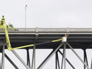 Bridges and underpasses are some of the hardest places to survey by hand. Traffic never stops, the most important details sit overhead or under a deck, and a crew can’t safely stand in the lane to measure them. LiDAR mapping solves much of that by using laser pulses to measure millions of points on every visible surface, often from the shoulder, a vehicle, or a drone. For engineers, contractors, and public agencies planning bridge work, it delivers a detailed record of existing conditions with less time spent in harm’s way.
Documenting Bridge Structures and Underpass Features With LiDAR
LiDAR documents a bridge or underpass by scanning every surface it can see and recording each hit as a point with a precise location. Together, those points form a 3D model of the structure as it stands today. A crew can capture decks, girders, piers, abutments, railings, and retaining walls in a single field effort.
Several scanning methods often work together on one project:
- Terrestrial scanners on tripods for detailed close-range capture
- Mobile scanners mounted on a vehicle to cover the roadway while driving with traffic
- Drone-mounted sensors for decks, approaches, and spots a ground crew can’t reach
The right mix depends on the structure, traffic volume, site access, and what the design team needs. Drone flights near roads and bridges may need airspace approvals and agency coordination. Ask your surveyor how they handle those steps before the schedule is set.
Capturing Clearance Heights and Hard-to-Reach Structural Details
Vertical clearance is the distance from the road surface to the lowest point of the structure overhead. It decides which trucks can pass safely and often shapes the design of resurfacing or widening projects. LiDAR records both the pavement and the underside of the bridge, so clearance can be measured at many points instead of a handful.
That matters because clearance isn’t uniform. Crowned pavement, past overlays, sagging members, and skewed alignments can move the low point from lane to lane. A dense point cloud lets the engineer find the true minimum clearance for each lane and each direction of travel.
The same scan captures bearings, beam ends, drainage scuppers, signs, light fixtures, and utility lines attached to the structure. In many cases, crews collect these without bucket trucks or long lane closures. LiDAR records surface shape only, so it doesn’t replace a hands-on structural inspection by a qualified inspector.
Mapping Roadway Elevations, Drainage Features, and Surrounding Terrain
Bridge projects rarely stop at the structure. The roadway approaches, ditches, embankments, and nearby ground all affect the design. LiDAR mapping captures these areas in the same dataset, giving the team one consistent picture of the corridor.
Roadway elevations come from the pavement points, which show cross slope, crown, and low spots. Inlets, curbs, swales, and outfalls show up wherever they’re exposed at the surface. Low points under an underpass often explain recurring ponding, and the survey helps the engineer see where water collects and where it can drain.
Some limits apply. LiDAR can’t see buried pipes, so underground utilities still need locating or subsurface utility engineering. Standard LiDAR also stops at the water surface, so a channel under a bridge typically needs a hydrographic survey for the underwater portion.
Using LiDAR Point Clouds for Engineering and Construction Planning
A point cloud is the raw set of measured points a LiDAR scan produces. Surveyors clean it, tie it to project control, and turn it into products the design team can work with. Typical deliverables include topographic surfaces, cross sections, 3D models, and CAD linework.
Engineers use these products to check how a new deck, widening, or railing fits against what’s already built. Contractors use them to plan beam placement, crane setup, and work zones. Accurate existing geometry cuts down on the surprises that lead to field changes once construction starts.
Ask the surveyor what file formats and coordinate system your team needs before fieldwork begins. Point clouds are large, and design software handles them differently. Agreeing on deliverables up front keeps the data usable the moment it arrives.
Verifying Existing Site Conditions Before Bridge Improvement Projects
Old as-built plans show what was designed, which isn’t always what was built or what stands today. Decades of overlays, repairs, and settlement can shift elevations and clearances. A current survey keeps design from starting on outdated numbers.
Before a bridge improvement project, confirm these points with your surveyor:
- Which project control and vertical datum the design team uses
- What accuracy the design or agency standards call for
- Which areas need scanning, including approaches and drainage outfalls
- How traffic control, lane closures, and right-of-way permits will be handled
- Whether underwater or underground data needs separate survey work
Requirements vary by agency, owner, and project scope. Public bridge work often follows specific survey standards, so confirm them during scoping. Starting early protects your schedule when design deadlines or funding milestones depend on the survey.
Frequently Asked Questions
Is LiDAR mapping accurate enough for bridge design?
It can be, when the scan is tied to solid survey control and checked against ground measurements. Accuracy depends on the scanner type, distance to the surface, surface conditions, and processing. Terrestrial scanning usually gives the tightest results for close-range structural details. Ask the surveyor to state the expected accuracy and explain how it will be verified.
Does LiDAR replace a bridge inspection?
No, it serves a different purpose. LiDAR measures the shape and position of visible surfaces. Inspections look at material condition, cracking, corrosion, and structural performance, and qualified inspectors carry them out under the owner’s program. LiDAR data can support an inspection, but it doesn’t stand in for one.
Can LiDAR measure clearance without closing lanes?
In many cases, yes. Mobile scanners and scanners set up off the travel lanes can capture both the pavement and the structure overhead. Some detail work or control setup may still call for short closures or shoulder work. Traffic control needs vary by agency and site, so plan for them during scoping.
For a free land surveying quote, call us at (727) 295-4195 or send us a message by going here.
Posted in Drone LiDAR Mapping | Tagged lidar mapping