
Choosing a Survey Company for a Cell Tower Lease Site
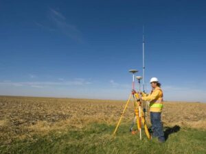
A cell tower lease can run for decades, and the survey drawn at the start usually follows it the whole way. If the lease area is off by a few feet, or the access road crosses land nobody meant to grant, the problem tends to show up years later. It often appears during an upgrade, a sale, or a refinance, when fixing it costs far more.
That’s why landowners and tower developers should consider more than proximity when choosing a land surveying company. . Cell tower sites call for a surveyor who understands lease exhibits, easement descriptions, and the specialized location data required for the project.
Why Cell Tower Lease Areas Need Precise Surveying
A cell tower lease area is the specific piece of ground a carrier or tower company rents. It’s often a small square carved out of a much larger parcel the owner keeps. Its edges have to be described so clearly that anyone can find them again, even after the tower or the land changes hands.
Precision matters for other reasons too. Tower companies commonly need location and elevation data for FAA filings, and many ask for an accuracy certification that states how closely the tower’s position and height were measured. Lenders and title companies may also want the lease area shown on an ALTA/NSPS survey. Exact needs vary by carrier, tower company, lender, and project, so ask for them in writing.
Defining Lease Boundaries and Access Easements
The lease exhibit is the drawing and legal description attached to the lease. It shows the lease area, the parent parcel, and any easements the tenant needs. A good exhibit ties each piece to the parcel boundary with measured distances and bearings, so the lines can be staked in the field.
Access and utility easements deserve as much care as the lease area. An access easement gives the tenant a legal right to cross your land, usually on a gravel drive or shared road. A utility easement lets power and fiber lines reach the equipment. If either one is drawn too wide, you may give up more ground than you meant to, and if it’s too narrow, crews may not fit trucks or cranes through later.
Before signing, landowners should check these points:
- Where the access route crosses parking, fields, or future building areas
- Whether easement widths match what the tenant actually needs
- If the lease area avoids setbacks and existing easements of record
- How the exhibit handles future expansion or a second carrier
Surveying Existing Improvements and Utility Connections
An existing conditions survey shows what’s already on the ground. For a tower site, that includes the tower, fenced compound, equipment cabinets, generators, guy anchors, and gates. On older sites, some of these items sit outside the leased area, and a survey is often the first time anyone notices.
Utility connections are part of this work. The surveyor locates visible poles, transformers, meters, and fiber handholes, and may coordinate with a locate service for buried lines. This shows whether utilities actually sit inside the easement the lease describes. It also helps owners avoid building over a live line later.
Topographic Data for Tower Site Planning
A topographic survey maps the shape of the ground with spot elevations and contour lines. Engineers use it to design the compound pad, the access drive, and drainage around the site. Without it, a new pad can push runoff onto nearby land or leave equipment sitting in a low spot.
Topo data also records ground elevation at the tower base, which feeds into the overall structure height used in FAA and local reviews. On low, flat sites, the survey may note the FEMA flood zone so designers can decide how high to set equipment. Whether a flood elevation certificate is needed depends on the project and the local permit office.
Survey Coordination Before Lease and Construction Decisions
The best time to bring in a surveyor is before lease terms are final. At that stage, the lease area and easements can still shift to avoid septic fields, wells, or areas you plan to build on. Once the lease is recorded, changing those lines usually takes an amendment and new legal descriptions.
Timing affects construction too. Site plans, permits, and construction staking typically rely on the survey, so a delay in the field can push back the whole schedule. When you compare local survey companies, ask each firm how many telecom sites it has handled and what deliverables it usually provides.
Get the scope in writing. It should list the lease exhibit, easement descriptions, existing conditions, topo, and any certifications the tenant or lender needs. This is general guidance and not legal advice, so have an attorney review the lease language before you sign.
Frequently Asked Questions
Who usually pays for a cell tower lease survey?
In many deals, the tower company or carrier orders and pays for the survey. It needs the data for design, permits, and federal filings. Terms vary from one lease to the next, though, and some landowners hire their own surveyor to review the tenant’s exhibits. Check your lease or letter of intent to see who is responsible.
What is a 1A accuracy certification?
A 1A certification is a surveyor’s statement that a tower’s position and elevation were measured within set tolerances. Those tolerances are 20 feet horizontally and 3 feet vertically. Carriers and tower companies often request it before submitting an FAA notice. Your surveyor can confirm which accuracy level your project calls for.
Can a lease area be moved after the lease is signed?
It’s possible, but it usually takes a lease amendment and new legal descriptions. The surveyor would prepare updated exhibits, and the change may need to be recorded. Lenders and title companies may also need to sign off. Settling the location before the lease is final is far easier.
Do I need an ALTA survey for a tower site?
Some buyers, lenders, and title companies ask for an ALTA/NSPS survey, especially for tower site sales or financing. Others accept a simpler lease exhibit and site survey. The need depends on the deal and who is insuring or funding it. Ask your lender or title company early so the right survey gets ordered once.
How long does a cell tower site survey take?
Field work on a simple site may take a day or two. Larger parcels with long access routes take longer, and records research and drafting add time. Weather, site access, and utility locates can also affect the schedule. Ask the surveyor for a timeline before you set closing or construction dates.
For a free land surveying quote, call us at (727) 295-4195 or send us a message by going here.
Posted in land surveying, land surveyor | Tagged cost of land surveying, estimating the cost of land surveying, land surveying cost, land surveying cost St. Petersburg