
Property Survey Cost for Sites With Multiple Easements
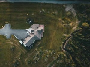
A property with one easement is easy to survey. A property with four or five is a much bigger job. If your land has several recorded easements, your property survey cost will likely be higher than a similar lot with a clean title. Why? The surveyor has to check and confirm a lot more before the drawing is done.
This article explains why many easements make a survey harder. It covers what records get checked before pricing, and how those extra rights affect the fieldwork and the final cost. By the end, you will know what drives the price up, and what to ask for when you order a survey.
Why Multiple Easements Can Increase Property Survey Complexity
One easement is one extra thing to check and map. Three or four easements mean the surveyor has to track down, confirm, and draw several rights on the same map. Each one may come from a different source. Each one may have a different width or set of rules.
Utility easements, access easements, drainage easements, and shared use easements can all sit on one property at the same time. They rarely line up in a neat way. One might run along the back line. Another might cut across the middle of the lot. A third might overlap a driveway that a few neighbors use.
Each easement gets checked against its own paper record. Then it gets placed on the map next to the property line and the other easements. More easements mean more checking. That checking takes real time. Time is a big part of what drives up a property survey cost.
Record Research Required Before Pricing a Survey With Multiple Easements
A surveyor cannot give a price on a job with several easements until they check the records first. This work happens before the quote is even final.
Common records a surveyor looks at include:
- Title papers tied to the current owner
- Easement agreements filed with the county
- Past surveys done on the same land
- Recorded plats that show the property’s history
- Other records that mention shared rights or limits
Some of these papers are easy to find. Others take real digging, especially if an easement was recorded long ago or is buried in a document that is hard to search. A property with five easements from five different sources takes much longer to research than one with a single easement listed clearly in a recent title report.
This research step shapes the whole project. Skip it, and the survey might miss an easement. That can lead to a dispute or a delay once construction starts.
How Easement Locations Affect Fieldwork and Survey Preparation Costs
Once the research is done, the field crew still has to check that the records match the real world. This step takes longer as the number of easements grows.
Surveyors often compare what the paper says to what they see on the ground. A drainage easement might be listed as a set distance from a fence, but that fence may have moved over the years. A shared driveway easement might not match the driveway anymore, since it could have been widened or shifted.
Field crews have to measure and check each easement. Then they compare it to buildings, access points, and other features already on the site. One easement is a quick check. Several easements turn this into a longer process, one step at a time.
This extra field work adds hours to the job. Those hours show up in the final price.
Why Survey Quotes Differ for Properties With Several Easement Restrictions
Two properties can be almost the same size and still get very different survey quotes. Easements are one of the biggest reasons why.
A property with clear records, a simple shape, and easy access will almost always cost less than one with several easements, messy paperwork, and an odd-shaped boundary. The number of easements matters. So does the quality of the records behind them. A vague or old easement description takes longer to figure out than a clear, well written one.
How easy the site is to reach also matters. A lot with thick brush, steep slopes, or few access points takes longer to walk and measure. That adds to the work no matter how many easements exist. Last, the level of detail in the final report changes the price too. A basic boundary survey costs less than one that maps every easement in full detail for a building project.
Planning a Property Survey When Easements May Affect Future Development
Owners, buyers, and builders all do better when they understand survey costs early, especially on a property with several easements.
Mapped easements show exactly where certain rights sit on a property. This matters for planning any new construction. A drainage easement might block where a new building can go. A utility easement might stop digging in a certain spot. An access easement might require a driveway or path to stay clear at all times.
Knowing this early helps avoid costly surprises later. A builder who sees the easements before finishing a site plan can design around them from day one. That beats finding a conflict after work has already started. This kind of early planning is one of the best reasons a detailed survey is worth the cost on a property with many easements.
Frequently Asked Questions
Do multiple easements make a property survey more expensive?
Yes. Several easements often mean more document checking, more research, and more fieldwork than a simple property needs. Each easement has to be checked and mapped on its own, which adds time to the job.
What types of easements can affect property survey costs?
Utility easements, access easements, drainage easements, and shared use easements can all add work. Each type needs its own research and field check, and having several on one lot adds up fast.
Does a property survey show all easements on a property?
It depends on the scope of the survey and what records are on file. Ask your surveyor if easement research and mapping are part of the job before you assume every easement will show up on the map.
Why might two similar-sized properties get different survey quotes?
The gap often comes from the number of easements, how clear the records are, the shape of the lot, and how easy the site is to reach and measure.
How can mapped easements help with future construction plans?
Mapped easements show where certain rights sit on a property. This helps owners and builders plan where to place buildings, access points, and other site work around those limits before work begins.
For a free land surveying quote, call us at (727) 295-4195 or send us a message by going here.
Posted in Boundary Survey | Tagged Boundary Survey