
Why a Topographic Survey Matters Before Drainage Improvements
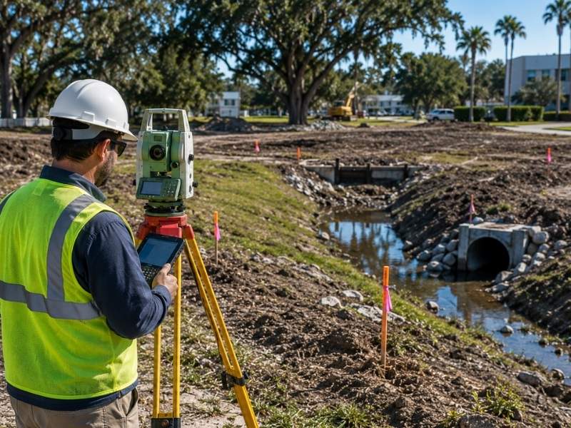
Drainage problems don’t fix themselves. They get worse.
A new swale, pipe, or retention area installed without accurate elevation data can push water onto a neighbor’s property, violate a SWFWMD permit, or simply fail to drain during the next heavy rain. All three outcomes cost more to fix than the original drainage project.
A topographic survey maps the actual ground elevations across your site before any design starts. That data tells your civil engineer where water currently flows, where it pools, and where a new drainage system has to send it. Without it, drainage design is based on assumptions. Assumptions fail in the field.
The Ground Data a Topo Survey Captures Before Any Pipe Gets Drawn
A topographic survey captures ground elevation at measured points across the entire property. It produces a detailed elevation map showing how the land rises and falls.
For drainage improvement projects, the survey records:
- Ground elevations across the full site at regular intervals
- Swale, ditch, and drainage feature locations and their invert elevations
- Existing pipe outfalls and their connection points
- Low spots where water collects after rain
- Elevation at property lines and adjacent right-of-way
- Any structures whose finished floor elevations need to be protected
Every one of those data points goes into the drainage design. Change one, and the design changes. Get one wrong, and the drainage system fails.
Three Reasons Drainage Work Goes Wrong Without Survey Data
St. Petersburg sits on a peninsula between Tampa Bay and the Gulf of Mexico. The city averages around 50 inches of rain per year. Most of that falls between June and September. The terrain is flat. There is no natural grade to carry stormwater away.
That combination means drainage problems here are harder to solve than in most other markets. The solutions are also harder to design without accurate field data.
A Six-Inch Grade Difference Can Reverse Your Entire Flow Path
In most cities, engineers can estimate drainage flow direction from general topography. In St. Petersburg, a six-inch elevation difference can reverse a flow path or create a new ponding area. A topographic survey captures those small changes. Without it, even a well-designed drainage system can send water the wrong direction.
Pipe Inverts Built Decades Ago That Nobody Confirmed Since
St. Petersburg has a lot of older drainage infrastructure. Some of it was installed decades ago. Records for those systems are incomplete. Pipe inverts don’t always match the as-built drawings on file at the city. A topographic survey documents the actual conditions on the ground. Your engineer designs to what’s actually there, not what the records say should be there.
The SWFWMD ERP Will Not Accept Estimated Numbers
Southwest Florida Water Management District (SWFWMD) regulates stormwater management permits in Pinellas County. Most drainage improvement projects that disturb more than a threshold area require a SWFWMD Environmental Resource Permit (ERP). That permit application requires accurate topographic data to show how the proposed drainage system handles runoff from the project site.
Submitting permit applications with estimated or inaccurate elevation data results in requests for additional information. Those requests add weeks to the permit timeline.
What Gets Designed Wrong When the Topo Is Missing
A Swale That Holds Water Instead of Moving It
A swale has to drain. To drain, it needs positive slope toward an outfall. In St. Petersburg’s flat terrain, that slope is often just a few tenths of a foot over a long run. A topographic survey gives the engineer the precise invert elevations needed to design a swale that actually flows. Without that precision, a swale built to design grades may hold standing water rather than move it.
Connecting to an Outfall That Can’t Accept Your Flow
Stormwater from your site has to go somewhere. In most cases in St. Petersburg, it goes into a city-maintained outfall system or a retention area sized to hold the runoff volume. A topographic survey locates existing outfall structures and records their rim and invert elevations. The engineer uses those elevations to confirm the proposed connection will work and won’t back up during storm events.
Raising Water Surface Elevations Against a Slab You Didn’t Measure
Any drainage improvement near an existing building must confirm that the new system won’t raise water surface elevations close to a finished floor. A topographic survey records existing finished floor elevations and the surrounding ground grades. The engineer uses that data to set design constraints before the drainage system is modeled.
Sizing a Pond on Grades That Only Exist on a Spreadsheet
Retention ponds in Pinellas County must be sized to hold a specific volume of runoff based on site area and impervious cover. The pond has to fit on the site at the right elevation to accept runoff from the graded area. A topographic survey shows available site area, existing grade, and the elevations at potential pond locations. Without it, pond sizing calculations are based on assumed grades that often don’t match the field.
The Stage When Most Developers Order It Too Late
Order it before the civil engineer starts design. That is the consistent answer across every drainage project type.
Many developers order topographic data after the engineer has already started design based on available GIS or LiDAR data. Public LiDAR data for Pinellas County has vertical accuracy of roughly 15 to 30 centimeters. That’s not accurate enough for drainage design in flat terrain where small elevation differences control flow direction.
Order a topographic survey when:
- The project requires a SWFWMD ERP or any stormwater management permit
- The site has known drainage problems or areas that hold standing water
- Any part of the site is near a FEMA Special Flood Hazard Area
- The project involves connecting to an existing drainage outfall structure
- The site has older infrastructure whose actual elevations haven’t been confirmed
Frequently Asked Questions
What is a topographic survey and why does drainage design need one?
A topographic survey records ground elevations across a site and shows how the land rises and falls. Drainage design requires it because water follows grade. Without accurate elevation data, engineers can’t predict where runoff goes or how to route it away from structures and property lines.
Can public LiDAR or GIS elevation data replace a topographic survey for a drainage project?
No. Public LiDAR data for Pinellas County has vertical accuracy of roughly 15 to 30 centimeters. Drainage design in St. Petersburg’s flat terrain requires accuracy of 0.1 feet or better. Only a site-specific survey by a licensed PSM meets that standard for permit submittals.
Does SWFWMD require a topographic survey for a drainage permit in Pinellas County?
SWFWMD requires accurate topographic data to support an Environmental Resource Permit application. The data must reflect actual site conditions. An ERP application submitted without certified survey data will generate a request for additional information, which delays the permit.
How does a topographic survey protect existing structures during drainage improvements?
The survey records finished floor elevations and the ground grades around existing buildings. The engineer uses that data to confirm the new drainage system won’t raise water surface elevations near those floors. Without those measurements, the design has no baseline to protect against.
What is the difference between a topographic survey and a drainage study?
A topographic survey is a field measurement product. It records existing ground elevations. A drainage study is an engineering analysis. It uses topographic data to model how water moves across a site under various storm conditions. The survey comes first. The study uses the survey data as input.
For a free land surveying quote, call us at (727) 295-4195 or send us a message by going here.